In part, I’m writing this brief post because I’m looking for suggestions for a new offline Android maps app.
You see, for years I was a loyal user of maps.me; simply search for the destination, then download a map of that region. That’s it.
For whatever reason, in the middle of 2022, I noticed major, shall we say “enhancements,” to borrow a hackneyed airline term. Indeed, app developers might be frequently creating updates to keep apps stable and secure, but whatever the heck happened to maps.me’s user interface made it nearly unusable. Every single aspect of the functionality worsened; not to mention, for whatever reason, all 400+ of my bookmarks were deleted. Even though I had an account, they wouldn’t reload.
Anyway, while it is often possible to use an older version of an app, that’s not the ideal choice. Thus, I’m curious what your alternatives to maps.me and Google Maps are; any recommendations for Baidu Maps?
Returning to the subject of the post, I love maps. In grade school, when other students might have been doodling images of Super Mario, Sonic the Hedgehog, or G.I. Joe, I was (attempting to) draw maps of imaginary airlines, U.S. state borders, and the South Pacific. The tv show Where in the World Is Carmen Sandiego? was my jam.
Ironically, once I started flying a lot, I was avoiding window seats as much as possible; getting up to chat with those Singapore Airlines FAs wearing kebaya was much more of a priority than ogling the ocean for hours on end.
Eventually, I caved in a little, booking window seats for flights slated to be 3.5 hours or less. I would have been remiss if I didn’t get to see Mt. Etna erupting, Niagara Falls up close, or that massive Buddhist complex on the final approach to Don Mueang Airport.
But maps take liberties depending on who is designing them, no? For instance, is it the Persian Gulf, or the Arabian Gulf? Sea of Japan, or East Sea? South China Sea or West Philippine Sea? (It’s not like there’s a patriotic sign bobbing up and down in those bodies of water to capture a passenger’s attention)
Another thought, are those borders drawn correctly?
How do you even define correctly?
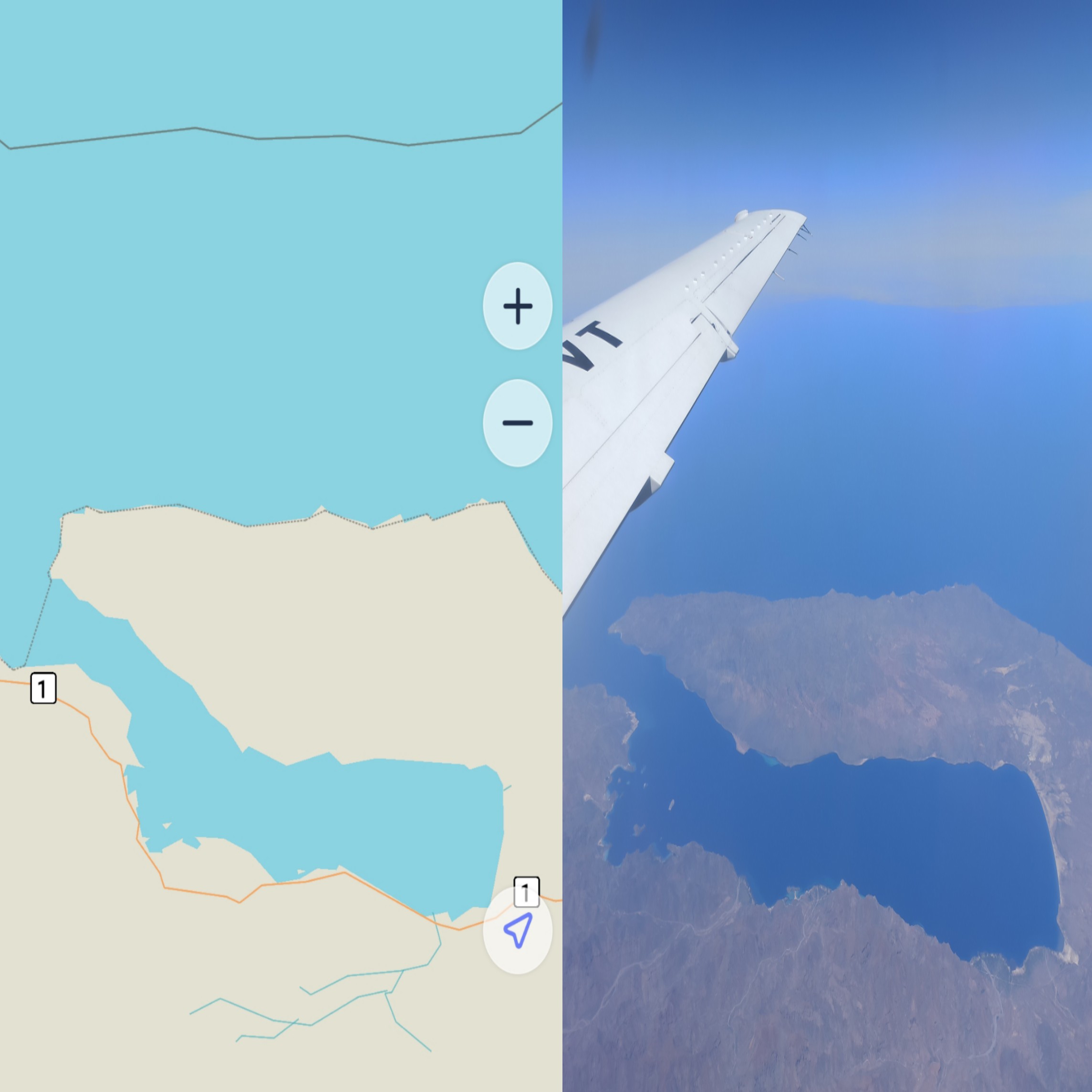
Those are awfully polemical questions, so I will take a simple approach and say, getting a window seat, and having a fondness for maps and geography sometimes pays off:

During my flight between La Paz, Mexico (LAP) and Tijuana, Mexico (TIJ), I took the photo on the right; if you’re interested in the exact location, it is located between Punta Coyote and La Cueva, looking Towards Isla San Francisco and Isla San José.
Do you think maps.me did a pretty good job?

Leave a Reply