Let’s have some fun with airline route maps.
With any luck — and memory — this will probably be a thread I’ll continually update, especially once I’m able to find the Delta inflight magazine that showed Kampuchea instead of Cambodia, or the one where Xian, China is listed as the more archaic Chang’an. Until those fateful findings happen, I’ve got a bunch of other maps to feed your imaginations for a while.
- North America Route Map")
On this years-old China Southern route map, the red lines stand for code-share flights, those being flights operated by China Southern’s partners (at the time, Delta). Oh, and Minneapolis relocates to Canada, southern Florida travels back to 2003, and New Zealand was set adrift in an historical direction.

Etihad of the United Arab Emirates went a bit overboard. I was flying from Abu Dhabi to Jakarta, but they generously wanted to impress me with their knowledge of world geography. Because what’s going on in Brasilia is going to affect my flight over the Bay of Bengal.
Good thing they don’t have any domestic routes.

If you squint well enough, you can see…the ocean. Taipei-Honolulu, another route I’m not sure why I flew.
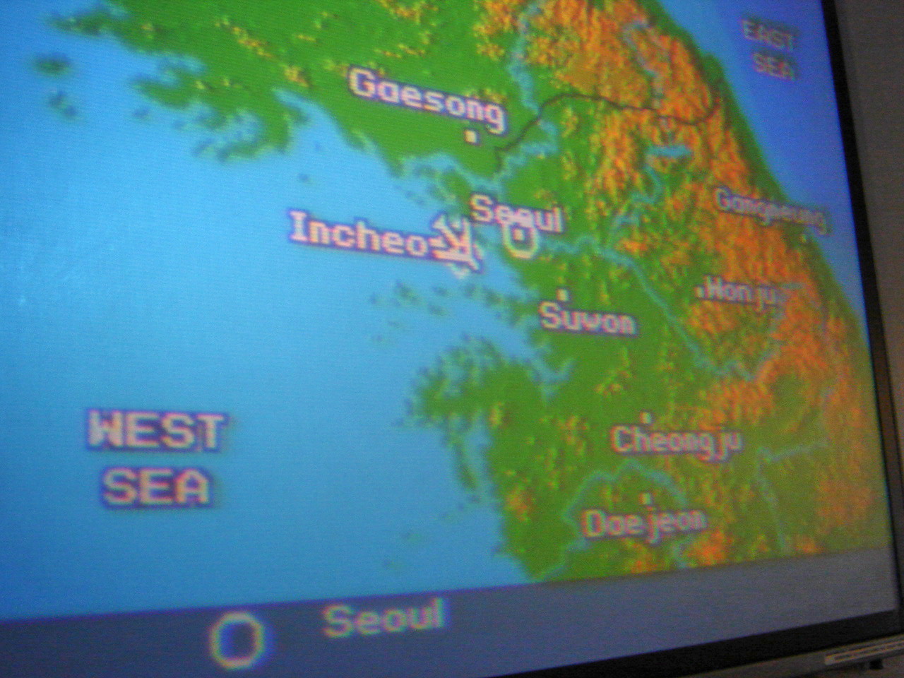
This one’s got two-in-the-hand! The West Sea is what the Korean Peninsula terms the Yellow Sea, nothing too offensive. But the East Sea. Well, in another never-ending spat with Japan, the Koreas can’t possibly agree with the Sea of Japan, so they just used their/an imagination. By the way, the Sea of Japan has some delicious Echizen crab….
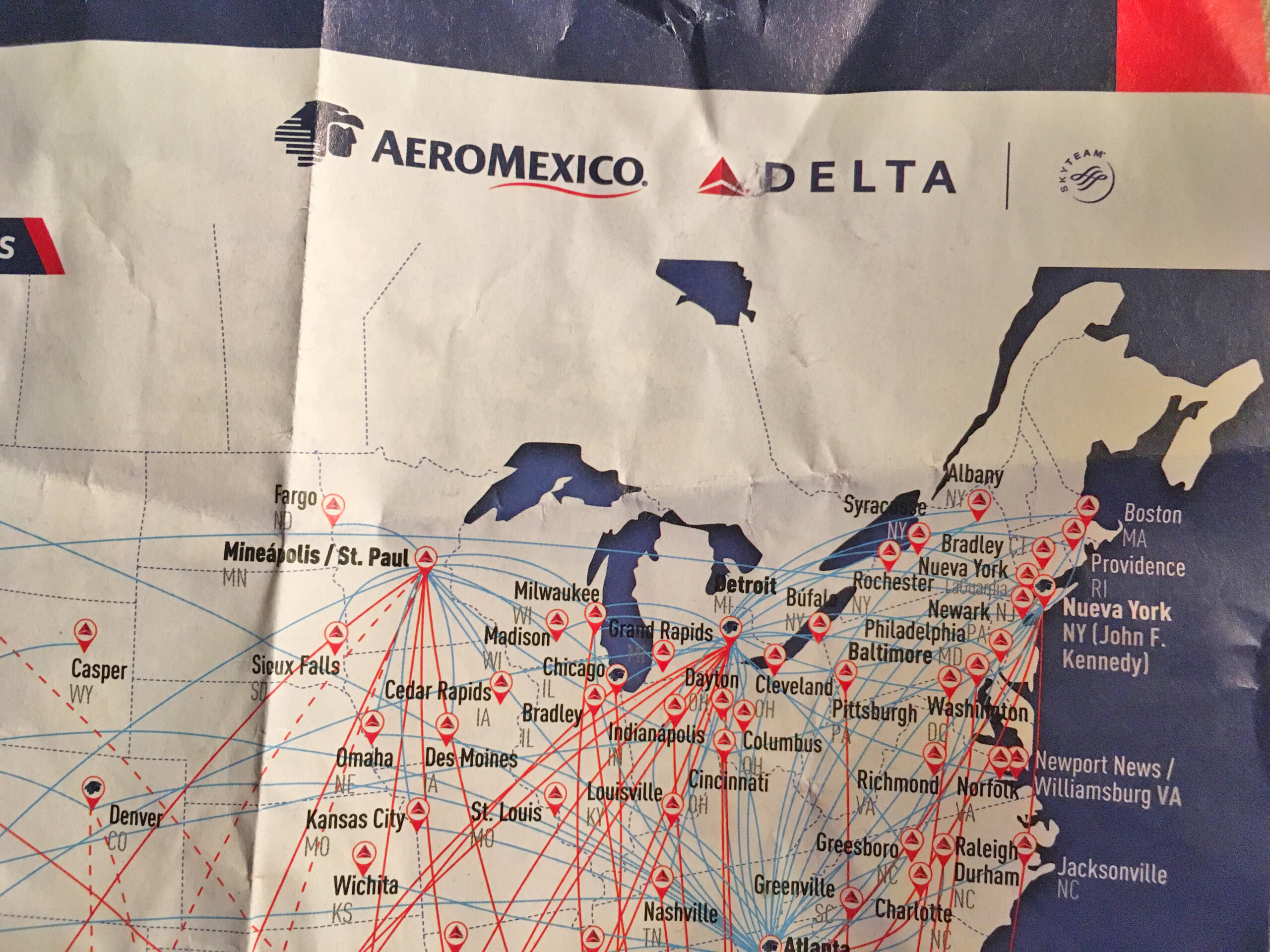
This Aeromexico route map requires more of a sleuth out of us.
Zoom into Connecticut and Illinois. Connecticut’s “Bradley” makes sense, as the busiest airport in the state is called Hartford Bradley (BDL). But Bradley, Illinois? There is a town by that name, and it is near Greater Kankakee Airport, but that one lacks commercial service.
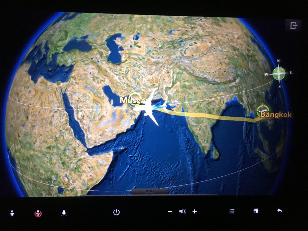
Maybe all airlines should just take a page from Oman Air’s book, and only label the origin and destination points:
Bonus
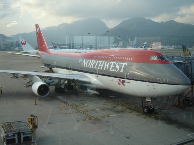
Here’s a lagniappe from 2005, when I flew a Northwest 747-400 from Hong Kong HKG to Tokyo NRT:
What are some unusual places/things you’ve noticed on airline route maps?

Leave a Reply